How can drones help reduce liability
Use case examples of how drone data can reduce your liability in construction.
Drones can effectively document preexisting conditions to reduce liability in construction projects. Here's how they can be utilized for this purpose:
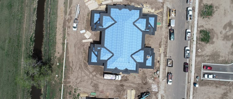
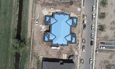
Aerial Imaging: Drones equipped with high-resolution cameras can capture detailed aerial images and videos of the project site before construction begins. These images provide a comprehensive visual record of the preexisting conditions, including the surrounding area, structures, vegetation, and infrastructure. By documenting the site accurately, construction companies can establish the baseline conditions, which can be essential for liability protection in case of disputes or claims arising from changes to the site during construction.
3D Mapping and Modeling: Drones can generate 3D maps and models of the site, incorporating preexisting conditions with precision. These models provide a detailed representation of the terrain, existing structures, and other elements. By creating a digital replica of the site, construction companies can document the preexisting conditions in a highly accurate and measurable format. This helps in identifying any potential conflicts or issues that may arise during construction, enabling proactive planning and risk management.
Time-Lapse Documentation: Drones can capture time-lapse videos or images of the site over an extended period, documenting any changes that occur naturally or due to external factors. This documentation is valuable in establishing the condition of the site at different stages, showcasing how it evolved over time. It can be particularly useful when dealing with claims related to property damage, environmental impacts, or changes caused by external events like natural disasters or neighboring construction activities.
Detailed Inspections: Drones equipped with advanced sensors, such as thermal imaging cameras or LiDAR, can provide detailed inspections of existing structures or infrastructure. These inspections help identify any preexisting defects, vulnerabilities, or maintenance issues that may need attention during the construction process. By thoroughly documenting such conditions, construction companies can demonstrate that they took reasonable measures to assess and address any preexisting problems, reducing liability for subsequent issues.
Geospatial Data Integration: Drone-captured data, including aerial images, 3D models, and mapping information, can be integrated with geospatial data systems. This integration allows for better analysis, comparison, and documentation of the preexisting conditions. It enables construction companies to align the drone data with other relevant data sources, such as property boundaries, utility lines, or environmental features. This comprehensive documentation facilitates accurate liability assessment and helps demonstrate compliance with regulations and standards.
By utilizing drones to document preexisting conditions through aerial imaging, 3D mapping, time-lapse documentation, detailed inspections, and geospatial data integration, construction companies can establish a solid foundation for liability protection. The comprehensive and accurate documentation reduces the risk of disputes, enhances transparency, and provides evidence of the conditions that existed prior to construction, thus mitigating potential liability claims.